


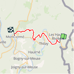
GR 16 Sorendal Montermé

ramagufa
User

Length
14.1 km

Max alt
422 m

Uphill gradient
578 m
Km-Effort
22 km

Min alt
139 m

Downhill gradient
609 m
Boucle
No
Creation date :
2019-04-16 19:16:31.873
Updated on :
2019-04-16 19:16:31.909
4h31
Difficulty : Medium

FREE GPS app for hiking
 SityTrail
IGN / Geographical institutes
SityTrail Plus
The world is yours!
About
Trail Walking of 14.1 km to be discovered at Grand Est, Ardennes, Les Hautes-Rivières. This trail is proposed by ramagufa.
Positioning
Country:
France
Region :
Grand Est
Department/Province :
Ardennes
Municipality :
Les Hautes-Rivières
Location:
Unknown
Start:(Dec)
Start:(UTM)
632606 ; 5526332 (31U) N.
Comments